
Explore GIS

Put your property records on the map.

GIS connects information to a location. Bring asset records, property boundaries, and field observations into a shared view your team can use. Explore a real example from our Plantation project below.

Imagery © Esri, Maxar, Earthstar Geographics, GIS User Community

Willow Site Plan · Amelia Island

A tree inventory you can explore.

The project

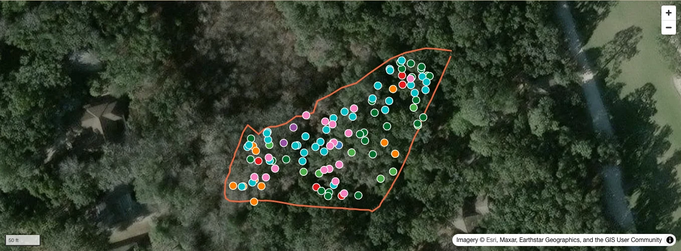
Our Willow Site Plan work for the Amelia Island Plantation Community Association brings tree locations and site information into an interactive map.

What this example contains

A local snapshot of 103 tree records and the site boundary. Choose a species, inspect an individual tree, toggle layers, and switch between satellite imagery and Plan view.

How to use it

Use the viewer to explore the inventory without changing it. This showcase is read-only and does not sync live with the original project. The full project remains linked below.

Built around your team

Web-based GIS delivery
Mobile-friendly field access
Organized asset records
Layer controls shaped around property operations
Presentation views for boards, vendors, and clients
A plan for maintaining and updating the data

From our project work

Willow Site Plan · Amelia Island Plantation

Full project (opens in a new tab)
Willow Site Plan tree inventory and boundary over satellite imagery on Amelia Island.

Imagery © Esri, Maxar, Earthstar Geographics, GIS User Community

A real project for the Amelia Island Plantation Community Association. Explore the tree inventory and site boundary here; open the full project for its additional layers and tools.