01
Tell us what you need
Describe the map, data task, or property question. Share any existing records and your intended use.

GIS & property operations · Fernandina Beach, FL
From one property map or a focused GIS task to asset inventories and complete web GIS systems. Based in Fernandina Beach, serving individuals, businesses, and communities across North Florida.
What we do
Get a property map, a presentation exhibit, cleaner GIS data, or help with a focused mapping task.
Explore serviceOrganize asset locations, condition, and responsibility into a useful inventory for inspections and planning.
Explore serviceConnect inventories, field observations, and property layers in an interactive map your team can use.
Explore serviceA project in practice
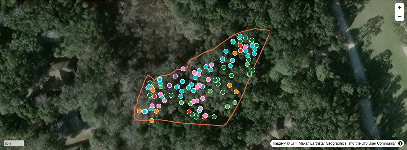
Explore the Willow Site Plan, part of our work for the Amelia Island Plantation Community Association. This view brings 103 mapped trees and the site boundary into one place.
Filter by species, inspect a tree, and switch between satellite imagery and a clear plan view. The full project includes additional sites, reference layers, and field tools.
From our project work
Imagery © Esri, Maxar, Earthstar Geographics, GIS User Community
How a project starts
01
Describe the map, data task, or property question. Share any existing records and your intended use.
02
We agree on the deliverables, source data, and quote before work begins. One map or one data task is a valid starting point.
03
Review the maps and records together, refine how they will be used, and establish how the information will stay current.
In development
Our maintenance management software is taking shape. Client access is coming soon.
Tell us what you need to show, understand, or organize. Remote mapping and field work are available across North Florida, with travel scoped per project.
Discuss a ProjectPartners & past work
Mapping and technical support for the people caring for our communities, properties, and landscapes.
Ongoing GIS, mapping, site plans, field data collection, and website support.
Visit partner website
Mapping support for Gardens of Amelia, helping local properties pursue arboretum accreditation.
Visit partner website
Site plans supporting property and tree-care projects.

Comprehensive GIS and site plans.

Amelia Island
Maps supporting arboretum accreditation efforts, prepared through Keep Nassau Beautiful.

Amelia Island
Maps supporting arboretum accreditation efforts, prepared through Keep Nassau Beautiful.

Amelia Island
Maps supporting arboretum accreditation efforts, prepared through Keep Nassau Beautiful.
A one-off map, a small tree inventory, a single property, or a presentation for an upcoming meeting—you don’t need a large portfolio or an ongoing software project to work with us.